Geographic Information Systems (GIS) are commonly utilized in a variety of fields because they allow for the development, analysis, and interpretation of multiple levels of spatial data in a quantitative way. Moreover, the combination of the cost-effectiveness and high quality of the final products make pursing GIS services a desirable option for many agencies. HRL’s GIS program is well-trained and equipped to meet the needs and standards of a wide range of projects. GIS support is commonly utilized by the other programs of HRL. Our services include:
GPS SURVEYING
HRL’s projects regularly involve field mapping. Data are logged via a professional grade Trimble® GPS data collector. The collected features are differentially corrected to ensure that the highest possible level of data accuracy is achieved. Data dictionaries are created to increase the efficiency of the field surveys and streamline the data processing procedure. Captured data are used, not only to depict the positions of real-world features, but also to quickly calculate area and volume. Depending on the project or request, data may be served in a variety of ways, including maps (hard copies or digital files), shapefiles, KMZ files, and / or geodatabase files. Typical examples of features that HRL staff survey include:
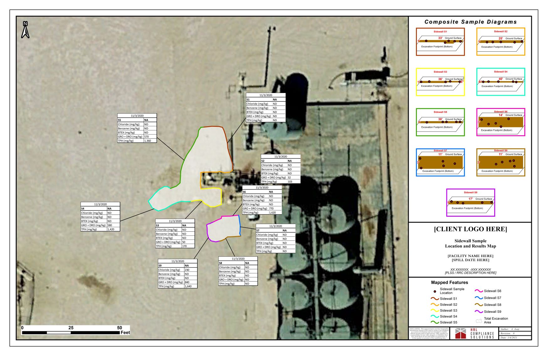
- Spill / Excavation Extents
- Sample Locations
- Pipeline / ROW Networks
- Plant Species Locations
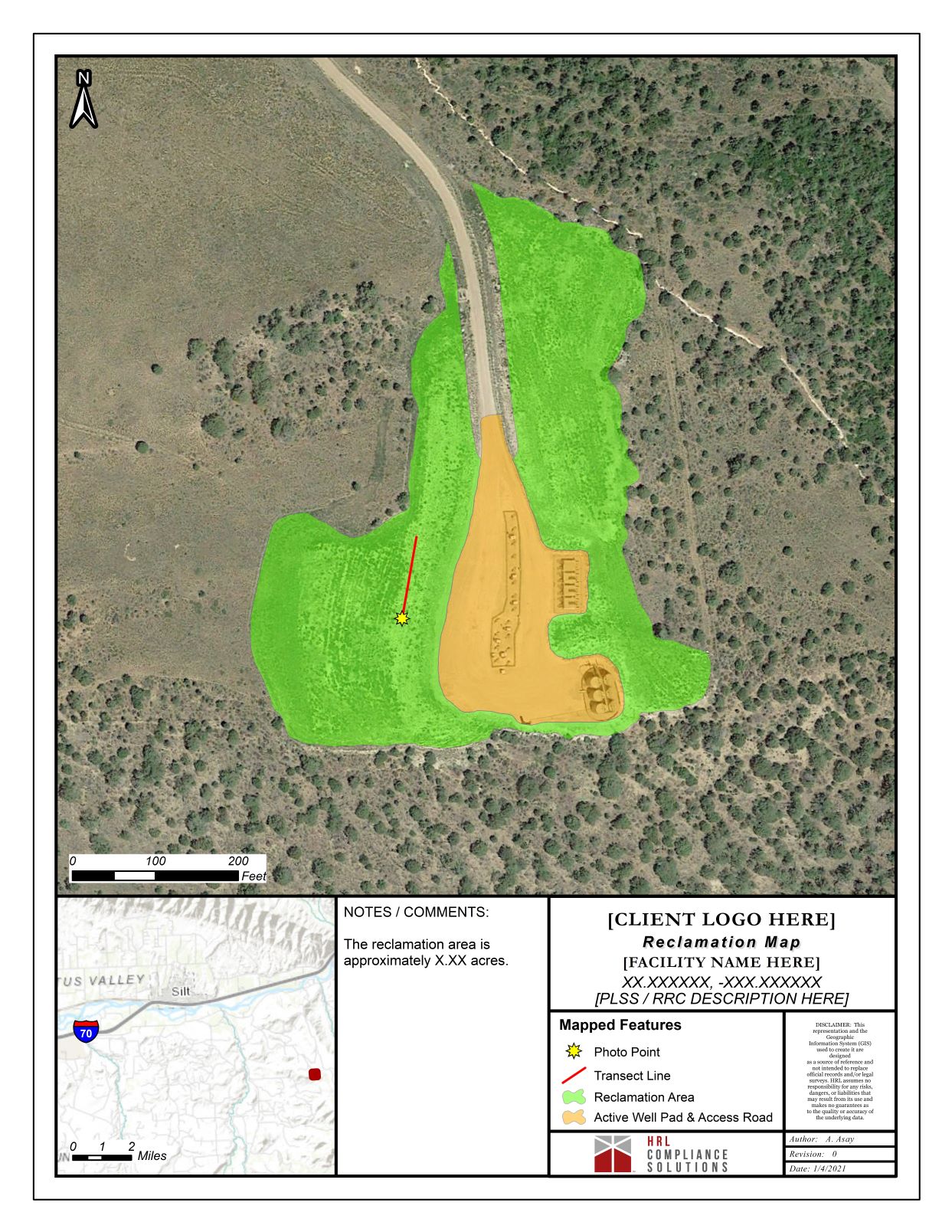
- Reclamation Areas / Re-seeding Areas
- Survey Transect Lines / Areas
- Wetlands Extents
MAP / DIAGRAM CREATION
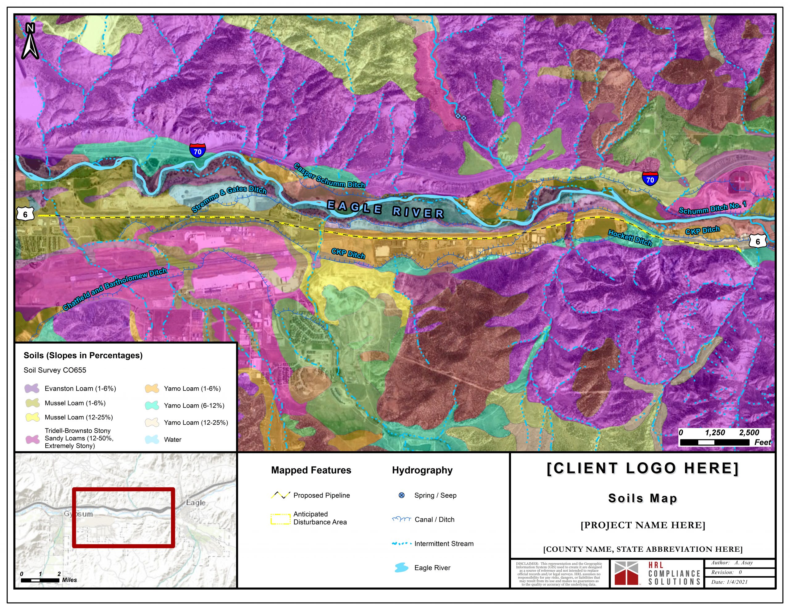
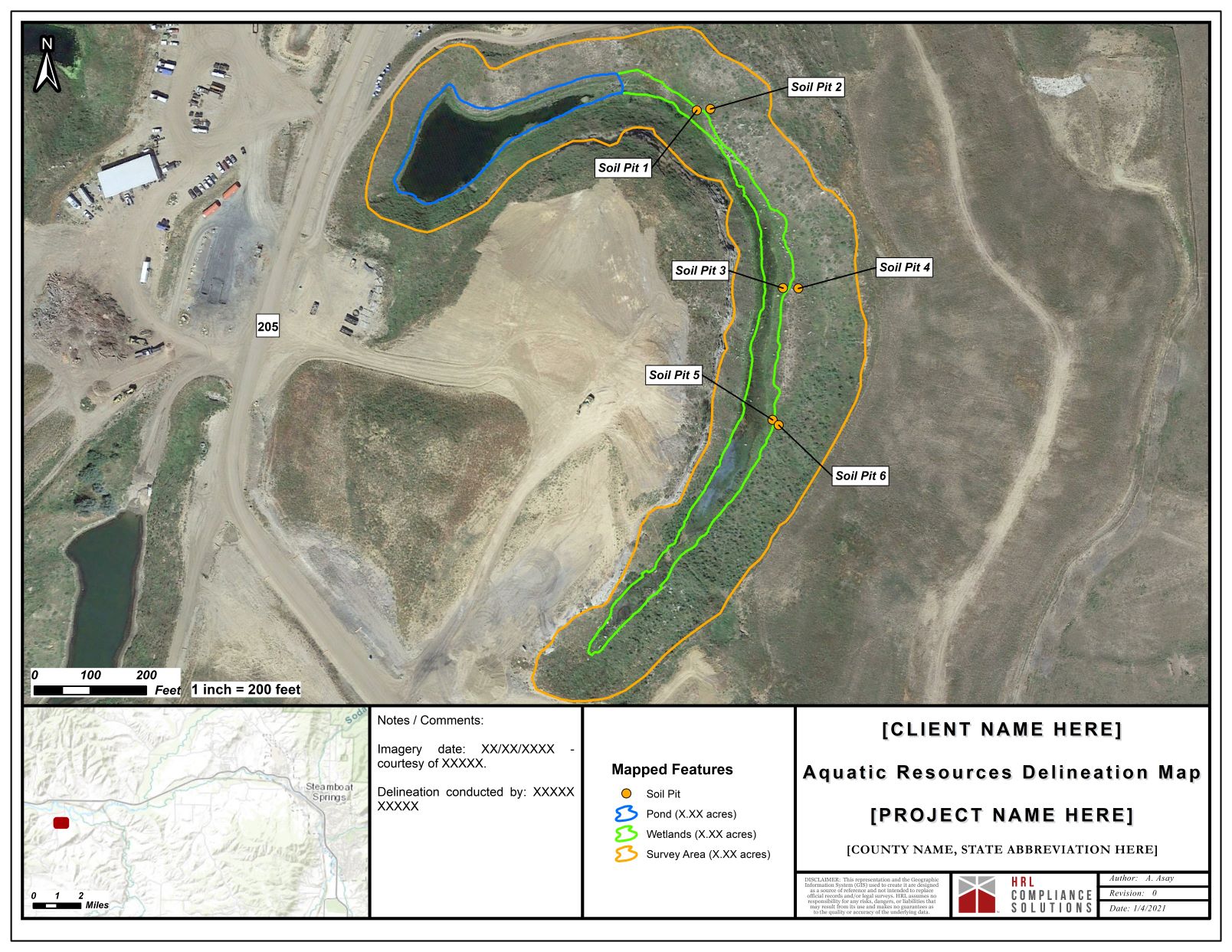
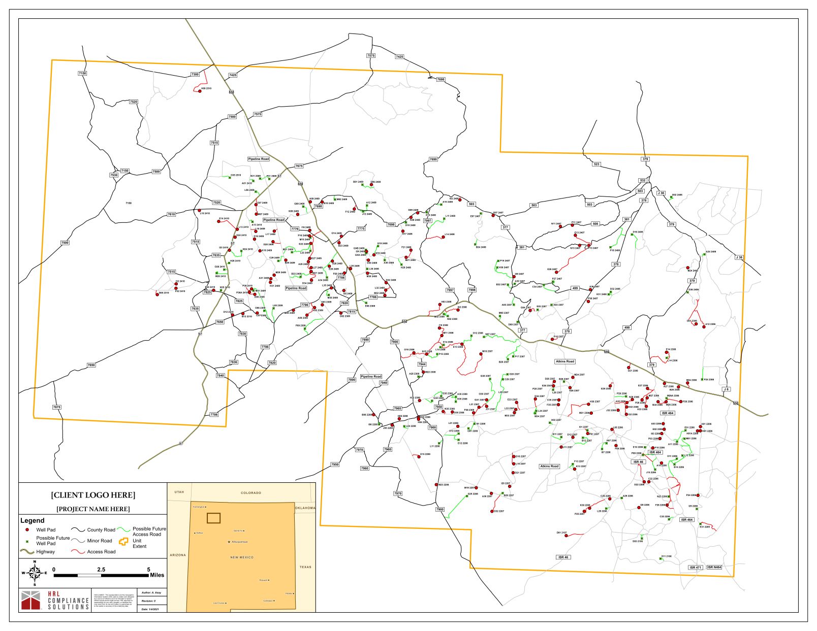
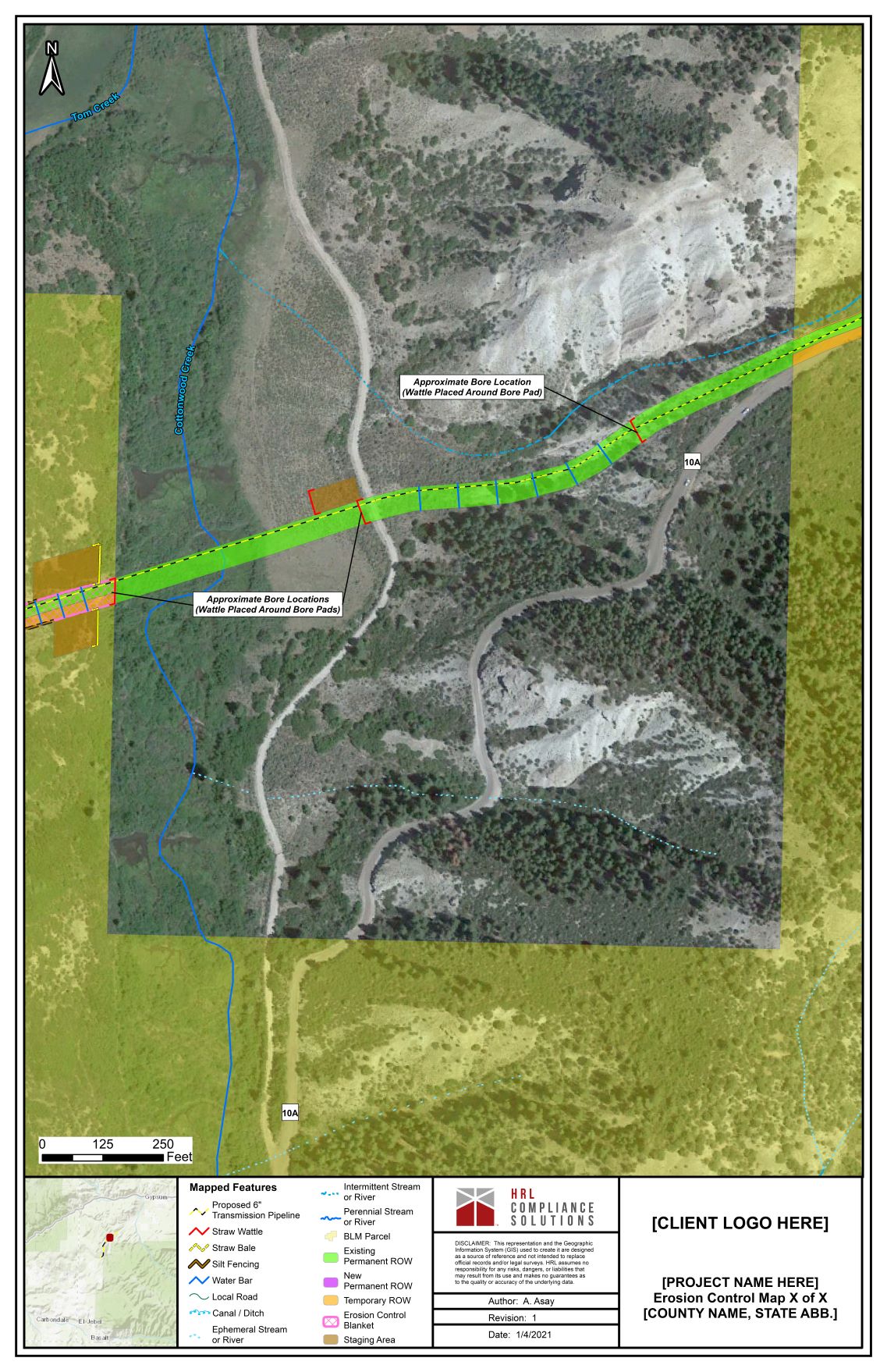
The GIS department of HRL can produce high-quality maps for any type of project or audience. From simple maps depicting a single feature to complex diagrams outlining a project’s full scope in detail, we ensure that the main points are communicated and clearly understood by the viewer. Symbologies and color schemes are carefully selected to enhance the features being depicted. HRL’s maps are used for a variety of purposes, such as:
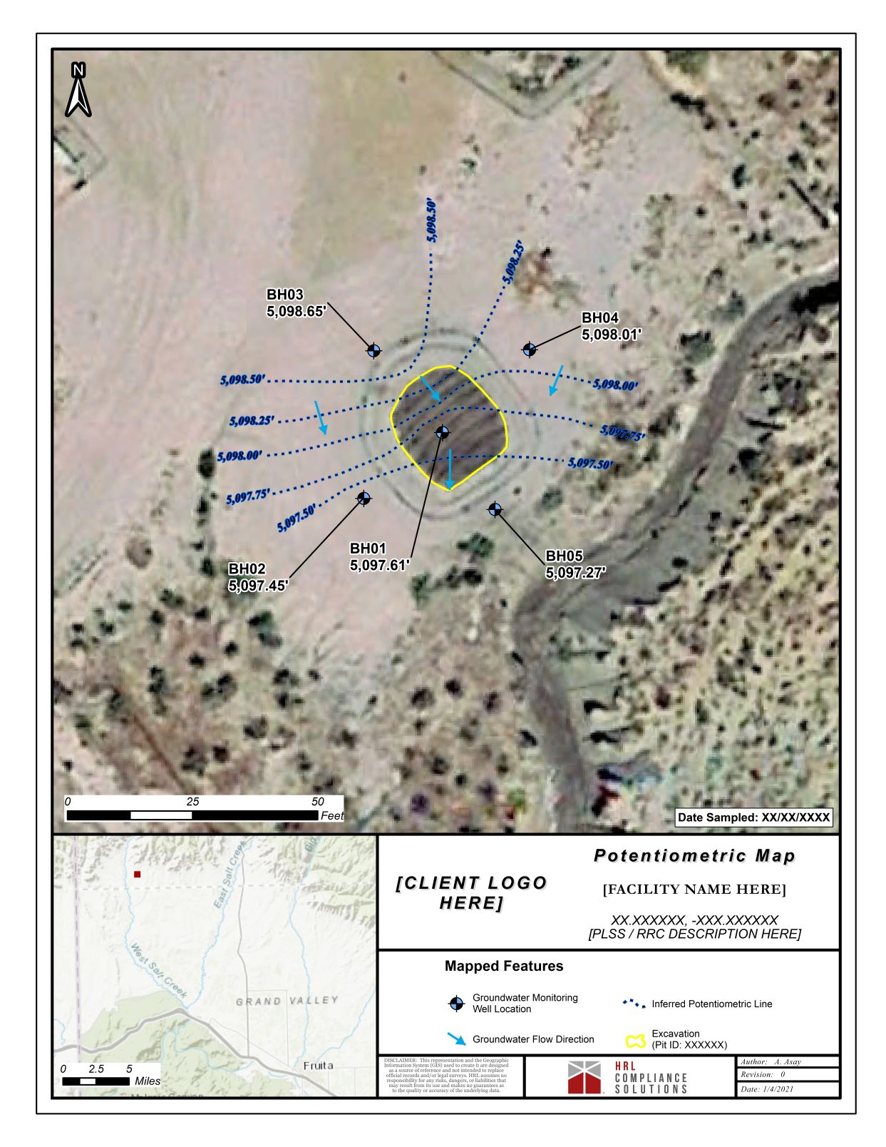
- Depth to Groundwater
- Groundwater Flow Direction
- Wetland Delineation / Aquatic Resources
- Site / Sample Locations
- Karst and Soil Classification
- Invasive Species Habitat
- Erosion Control
- Flowline Registration
- Depicting Legal Descriptions for Easements / ROWs
DATABASE MANAGEMENT
HRL’s GIS program can also provide a system in which the client can prepare his own maps without having to manage the bulk of the data. With this service, HRL establishes a system of geodatabases and datasets, sets up map templates, and creates symbologies, per the client’s standards. By means of ESRI’s ArcReader® program, these files are then shared with the client, who can manipulate the layering of the data and generate his own custom maps.
![]()